The Master Guide

Tanzania Destinations.

Thirteen of the most extraordinary protected areas in East Africa, each with its own character, wildlife, and history. This guide is built from Nelson's decades of guiding experience on every one of them.

Mount Kilimanjaro National Park

Mount Kilimanjaro National Park

Size
1,688 sq km (652 square miles)
Status
National Park & UNESCO World Heritage Site
Year Established
1973
Best Known For
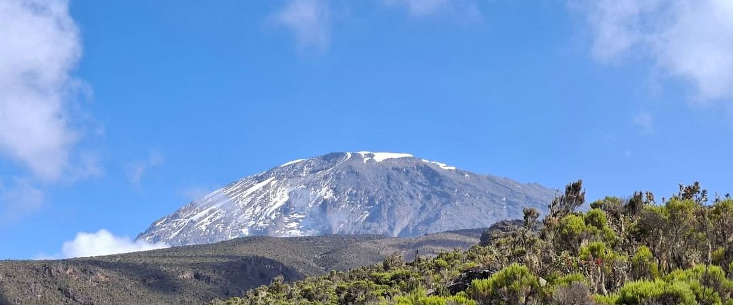
Hosting Mount Kilimanjaro, Africa's tallest peak and the world's highest free-standing mountain.

Mount Kilimanjaro National Park is a place of dramatic contrasts, where equatorial heat meets arctic ice. Rising majestically from the dry savannah plains of northern Tanzania, this iconic park protects the world's tallest free-standing volcanic massif. The park is a global magnet for hikers, adventurers, and outdoor enthusiasts who wish to test their limits and stand on the rooftop of Africa at Uhuru Peak.

What makes a Kilimanjaro trek truly unique is the journey through five distinct climate zones in a matter of days. Hikers pass through lush, tropical rainforests, alpine moorlands covered in prehistoric plant life, stark high-altitude deserts, and finally, an arctic summit zone defined by massive glacial ice fields. This ecological diversity offers an unparalleled trekking experience that feels like walking from the equator to Antarctica in a single week.

Wildlife Profile

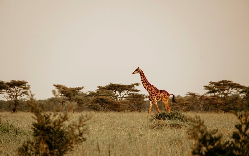
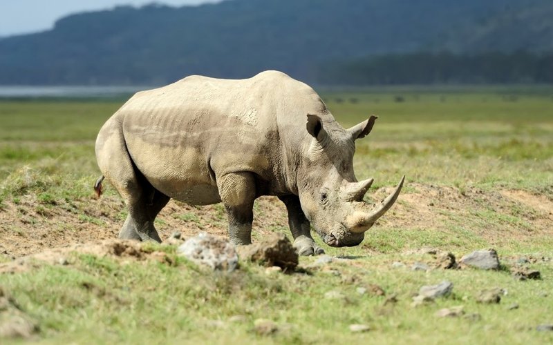
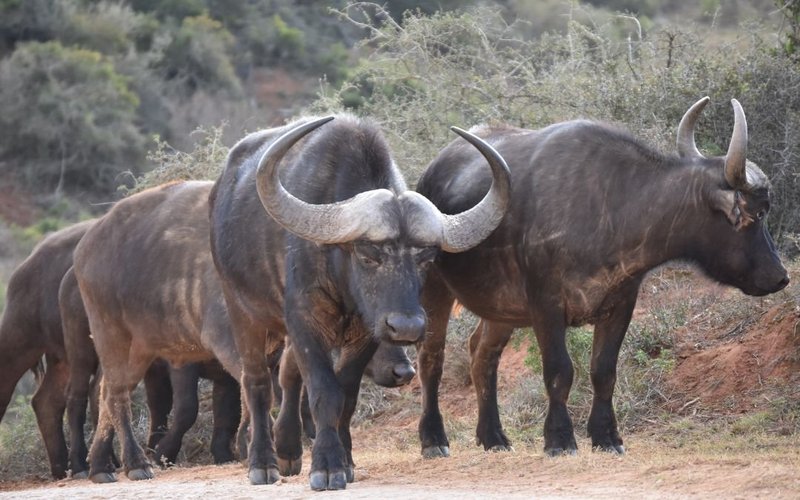
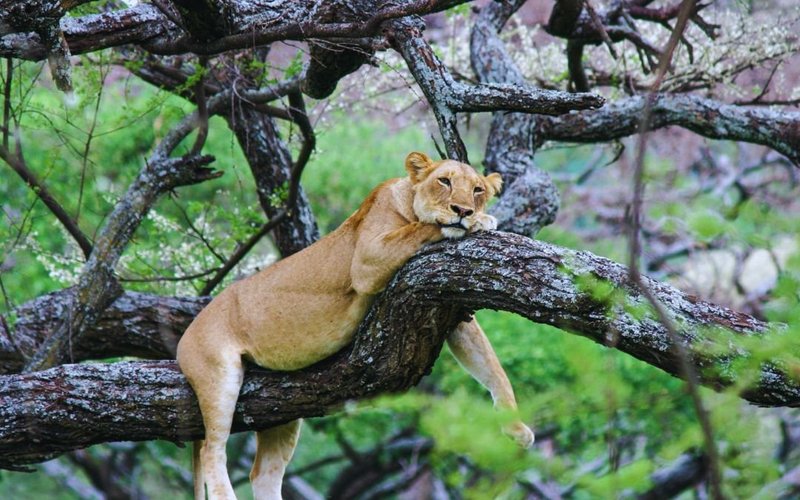
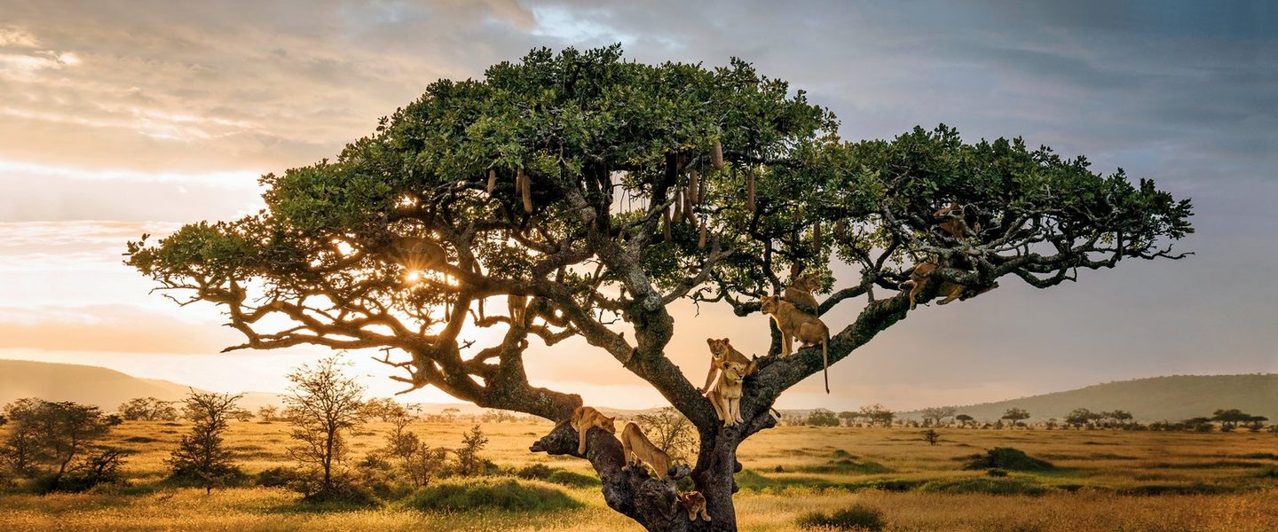
While Kilimanjaro is primarily celebrated for its dramatic landscapes and trekking routes, its dense montane forests shelter a surprising variety of wildlife. Lucky hikers may spot beautiful black-and-white colobus monkeys, blue monkeys, and agile olive baboons swinging through the canopy. The lower forest zones are also home to elusive leopards, bushbacks, and small antelopes like the red duiker. In the higher alpine moorlands, specialized high-altitude species such as the alpine chat, white-necked raven, and four-striped grass mouse thrive in the rugged environment.

Historical Background

Long before international trekkers arrived, Mount Kilimanjaro was revered by the local Chagga people, who called the mountain home for centuries and based their agricultural lifestyle around its fertile, volcanic soils. The first recorded European to sight the snow-capped peak was German missionary Johannes Rebmann in 1848, whose reports of snow on the equator were initially met with widespread skepticism in Europe. The mountain was first successfully climbed in 1889 by German geographer Hans Meyer and Austrian mountaineer Ludwig Purtscheller, alongside their legendary Chagga guide, Yohani Lauwo. Recognizing its immense ecological and cultural global value, the Tanzanian government formally established the area as a national park in 1973, and UNESCO declared it a World Heritage Site in 1987.

Frequently Asked Questions

What is the most successful route to climb Kilimanjaro?

Routes like the Machame (Whiskey) Route and Lemosho Route offer the highest summit success rates because their longer itineraries allow for excellent natural altitude acclimatization ('climb high, sleep low').

Do I need technical mountaineering skills to climb Kilimanjaro?

No. Kilimanjaro is a 'trekking mountain,' meaning it requires no ropes, ice axes, or technical rock-climbing experience. It is a demanding, long-distance trek that requires exceptional physical stamina and strong cardiovascular fitness.

Plan a trip to Mount Kilimanjaro National Park →

Serengeti National Park, wildebeest migration

Serengeti National Park

Size
14,763 sq km (5,700 square miles)
Status
National Park & UNESCO World Heritage Site
Year Established
1951
Best Known For
The Great Wildebeest Migration, massive lion populations, and endless savannah horizons.

Serengeti National Park is the undisputed crown jewel of Africa's wildlife sanctuaries. Derived from the Maasai word Siringet, meaning 'the land of endless plains,' this massive wilderness area features vast, sun-drenched grasslands, granite rock formations (kopjes), and acacia woodlands. It offers the quintessential African safari experience, where wide-open horizons create a sense of timeless freedom and raw nature.

The Serengeti is globally famous for hosting the Great Wildebeest Migration, a continuous, year-round journey of over two million wildebeest, zebras, and gazelles. This dramatic spectacle is a relentless search for fresh water and green grass, presenting a thrilling theater of life and death as massive herds brave crocodile-infested rivers and predatory ambush fields across the savannah.

Wildlife Profile

The Serengeti offers unmatched year-round wildlife viewing and boasts some of the highest concentrations of large predators on earth. It is a premier destination to check off the legendary 'Big Five', lion, leopard, African elephant, Cape buffalo, and the rare black rhino. Prides of lions numbering up to forty individuals roam the plains, while leopards lazily drape themselves across acacia branches. The park is also home to swift cheetahs, spotted hyenas, serval cats, and hundreds of bird species, making it an absolute paradise for photographers and birdwatchers.

Historical Background

For thousands of years, the Serengeti plains were utilized as open grazing lands by nomadic pastoralist communities, particularly the Maasai, who lived in ecological balance with the wildlife herds. In the early 20th century, European explorers and big-game hunters arrived, rapidly decimating local wildlife populations through unregulated trophy hunting. Realizing the urgent need for habitat preservation, British colonial authorities established a small game reserve in 1921, which was expanded and officially gazetted as Tanzania’s first national park in 1951. Today, it stands as a globally celebrated model for conservation and ecological research.

Frequently Asked Questions

Can I see the Great Wildebeest Migration river crossings on a day trip to the Serengeti?

No. The dramatic Mara River crossings happen in the far northern Serengeti, near the Kenyan border. Driving from Arusha or central Serengeti to that region takes several hours each way, so a day trip is not realistic. A minimum of three to four days inside the park is needed to reach and watch the crossings properly.

Are open-sided safari vehicles allowed in the Serengeti?

Generally, no. For standard mobile safaris driving into the Serengeti from Arusha, fully closed 4x4 vehicles with pop-up roofs are required because of the long distances and highway transit. Fully open-sided vehicles are mostly restricted to fly-in guests staying at specific luxury camps within their immediate private concessions.

Why is the Serengeti split into different regions for planning?

The park is massive (14,763 sq km) and wildlife patterns shift completely depending on the time of year. Central Serengeti (Seronera) has fantastic resident game and big cats year-round. The Western Corridor is famous for the Grumeti River crossings in May and June. The North hosts the Mara River crossings from July to October. The South (Ndutu) is the place to be for the wildebeest calving season from January to March.

Is it safe to stay in mobile tented camps in the Serengeti with no fences?

Yes, it is remarkably safe, provided you follow camp rules. Wild animals walk freely through the camps at night, which is part of the experience. You are instructed never to walk alone after dark. A Maasai guide or camp guard escorts you to and from your tent.

Can I do a walking safari anywhere in the Serengeti?

Walking safaris are strictly prohibited inside the main public areas of the national park. However, designated wilderness zones and private concessions adjacent to the park allow specially authorised guided walking safaris accompanied by armed park rangers.

Plan a trip to Serengeti National Park →

Ngorongoro Crater

Ngorongoro Conservation Area

Size
8,292 sq km (3,201 square miles)
Status
Conservation Area & UNESCO World Heritage Site
Year Established
1959
Best Known For
The Ngorongoro Crater, the world's largest intact volcanic caldera, and pioneering multiple land-use management.

Often described as the Eighth Wonder of the World, the Ngorongoro Conservation Area is a breathtaking geographical marvel. At its heart lies the world-famous Ngorongoro Crater, a massive, enclosed volcanic caldera that plunged inward millions of years ago when a giant volcano, once taller than Mount Kilimanjaro, erupted and collapsed. The resulting bowl creates a completely unique, self-contained ecosystem with walls rising 2,000 feet (610 m) above a crater floor rich in mineral grass, fresh springs, and alkaline lakes.

Unlike traditional national parks, Ngorongoro operates under a pioneering multiple land-use system. Here, wildlife conservation areas coexist seamlessly with semi-nomadic Maasai pastoralists, who have legal rights to graze their cattle on the outer crater plains. Descending into the crater offers a dramatic safari experience where vast herds of wildlife interact within a striking, amphitheater-like volcanic backdrop.

Wildlife Profile

The Ngorongoro Crater floor features an incredibly high density of large mammals, sheltering roughly 25,000 animals at any given time. It is widely considered your absolute best chance in East Africa to view the highly endangered black rhino in the wild. The crater floor is also home to massive, legendary 'big tusker' elephants, dense prides of black-maned lions, spotted hyenas, leopards, blue wildebeests, grants zebras, and hippos cooling off in the Lerai Forest swamps.

Historical Background

Fossil evidence from the nearby Olduvai Gorge proves that early hominids walked this exact landscape over three million years ago, making Ngorongoro the literal 'Cradle of Mankind.' In more recent centuries, the area was populated by the Mbulu and Datoga tribes before the Maasai became the dominant community in the 19th century. Initially protected as part of the original Serengeti complex, the Tanzanian government separated Ngorongoro in 1959 to create a specialized conservation area that balanced the rights of indigenous people with wildlife protection. UNESCO recognized its outstanding universal value by declaring it a World Heritage Site in 1979.

Frequently Asked Questions

Can I see all of the Big Five inside the Ngorongoro Crater in a single day?

The Ngorongoro Crater gives you the best chance in East Africa to see all Big Five animals in one day. Buffalo, elephant, lion, and leopard are common, and the crater floor protects Tanzania's last remaining wild black rhinos.

Why is there a time limit on game drives inside the Ngorongoro Crater?

To manage traffic congestion and protect the delicate ecosystem, crater entry permits are valid for a maximum of six hours. Most operators structure this as either a morning or an afternoon session.

Are there elephants inside the Ngorongoro Crater, and can they climb out?

Yes, there are elephants on the crater floor, but you will almost exclusively see large, older bull elephants. Breeding herds with females and calves generally stay up in the denser forests of the crater rim because the steep descent paths are too hazardous for the young calves.

Is the Ngorongoro Crater a national park?

No, it is a Conservation Area. The key distinction is that it is a pioneering multi-use landscape where the indigenous Maasai people live, herd cattle, and share the environment alongside wild animals, whereas human habitation is completely illegal in standard national parks like the Serengeti.

Why is it so cold on the rim of the Ngorongoro Crater if it is in Africa?

The crater rim sits at a high altitude of roughly 2,200 m (7,217 ft) above sea level. While the crater floor is warm, the rim sees heavy fog, brisk winds, and cold temperatures in the evenings and early mornings. Warm layers and a proper jacket are essential.

Plan a trip to Ngorongoro Conservation Area →

Tarangire National Park, elephants and baobabs

Tarangire National Park

Size
2,850 sq km (1,100 square miles)
Status
National Park
Year Established
1970
Best Known For
Massive elephant herds, ancient baobab trees, and exceptional dry-season game viewing.

Tarangire National Park offers a beautifully rugged and untamed safari landscape that stands out from the rest of the Northern Circuit. Famous for its iconic giant baobab trees that pierce the golden skyline, the park is bisected by the permanent Tarangire River. This seasonal wilderness undergoes a dramatic transformation each year, turning from a quiet, green expanse into a bustling wildlife haven.

During the dry season from July to October, Tarangire becomes an absolute magnet for wildlife as surrounding migratory water sources dry up completely. The life-giving Tarangire River becomes the only reliable water supply for miles, drawing thousands of animals from across the Maasai Steppe. This mass migration creates spectacular game-viewing opportunities along the river banks, establishing Tarangire as a true hidden gem for safari enthusiasts.

Wildlife Profile

Tarangire is globally renowned for hosting some of the largest elephant herds in Africa, with groups of up to 300 elephants frequently seen excavating dry riverbeds for underground streams. The park is also a premier destination to spot massive Cape buffalo herds, majestic fringe-eared oryx, and rare long-necked gerenuks. Predators are highly active here, with regular sightings of lions roaming the savannah, tree-climbing leopards hiding in sausage trees, and wild dogs moving through the brush.

Historical Background

The park draws its name directly from the Tarangire River, a vital waterway that has shaped the human and ecological history of the region for millennia. Historically utilized as ancestral hunting grounds by indigenous hunter-gatherer communities and later as winter grazing zones by Maasai pastoralists, the area faced heavy pressure from big-game hunting during the colonial era. Recognizing its critical importance as a dry-season refuge within the larger East African ecosystem, the Tanzanian government officially gazetted Tarangire as a national park in 1970.

Frequently Asked Questions

Why is Tarangire considered the best alternative to the Serengeti during the dry season?

During the dry season from July to October, the Tarangire River becomes the only permanent water source in the entire region. That triggers a massive mini-migration, drawing thousands of elephants, wildebeest, and zebra from the dry Maasai Steppe straight to the river banks.

Is Tarangire a good safari destination during the green or rainy season?

Wildlife viewing drops noticeably during the wet season (April to May). Because water is abundant everywhere, the herds disperse deep into the surrounding Maasai Steppe, away from the park's road network, which makes them much harder to find.

Are tsetse flies really a problem in Tarangire, and how do I avoid them?

Tarangire does have pockets of tsetse flies, particularly in the dense woodlands. Their bites are annoying but rarely dangerous to humans. To avoid attracting them, never wear dark blue or black clothing, and use an insect repellent containing DEET.

What makes the landscape of Tarangire geographically unique?

Tarangire is famous for its iconic, ancient baobab trees that dominate the horizon. These massive, prehistoric-looking trees can live for thousands of years, and elephants frequently use their tusks to gouge the bark for water during dry periods.

Can I see tree-climbing lions in Tarangire National Park?

While Lake Manyara is more famous for this behaviour, the lions in Tarangire also frequently climb trees to escape the ground heat, avoid tsetse flies, or get a better vantage point for hunting plains game.

Plan a trip to Tarangire National Park →

Lake Manyara National Park

Lake Manyara National Park

Size
330 sq km (127 square miles), of which up to 200 sq km is the lake
Status
National Park & UNESCO Biosphere Reserve
Year Established
1960
Best Known For
Legendary tree-climbing lions, massive baboon troops, and vibrant pink flamingo flocks.

Nestled dramatically at the base of the Great Rift Valley's sheer 2,000-foot western escarpment, Lake Manyara National Park is a scenic gem that packs incredible ecological diversity into a compact area. The journey through the park begins in a lush, emerald-green groundwater forest fed by underground springs, which quickly transitions into open grasslands, acacia woodlands, and finally, the expansive shores of the shallow alkaline lake.

The park offers an intimate safari experience where the scenery changes around every bend. Ernest Hemingway famously described Lake Manyara as 'the loveliest I had seen in Africa,' a sentiment that holds true today. Despite its smaller size compared to its northern neighbors, the park provides an ideal combination of spectacular birdlife, unique predator behaviors, and dramatic geological backdrops.

Wildlife Profile

Lake Manyara is globally famous for its unique population of tree-climbing lions, which routinely rest high on the branches of acacia trees to escape the ground heat and insect swarms. The groundwater forest supports some of the largest olive baboon troops in Africa, alongside elegant blue monkeys and black-and-white colobus monkeys. The lake itself is a haven for waterbirds, transforming into a shimmering sea of pink when thousands of migratory lesser flamingos line its mineral-rich shores.

Historical Background

The area surrounding Lake Manyara has served as an ancient crossroads for diverse human cultures, with local Mto wa Mbu village remaining one of the only places in Africa where over 120 distinct tribes live together in harmony. In the early 20th century, the area was designated as a sports hunting ground before being upgraded to a game reserve in 1957. Upon gaining independence, Tanzania officially established it as a national park in 1960, and it was later designated a UNESCO Biosphere Reserve to protect its delicate wetlands.

Frequently Asked Questions

Why are the lions in Lake Manyara famous for climbing trees?

While there is no definitive scientific consensus, guides observe that Manyara's lions climb trees to escape the intense ground heat, avoid biting insects like tsetse flies, and gain a clear view through the thick mahogany forest canopy.

Is Lake Manyara a deep lake where you can go boating?

No, Lake Manyara is a shallow, alkaline soda lake. Water levels fluctuate dramatically with the seasonal rains. When the water is high, some operators offer specialised canoeing safaris, but during dry spells the lake retreats into expansive mudflats.

What unique primate species can I see in Lake Manyara's groundwater forest?

As soon as you pass the park gate, you enter a lush groundwater forest that hosts the highest concentration of baboons in Africa. You will also easily spot blue monkeys and vervet monkeys swinging through the canopy.

Are there flamingos at Lake Manyara year-round?

Flamingo populations fluctuate with water levels and the salinity of the lake, which dictates the abundance of the algae they feed on. You can often see thousands of lesser flamingos painting the lake pink, but they occasionally migrate to nearby Lake Natron for nesting.

How long does a standard safari game drive take in Lake Manyara?

Because Lake Manyara is a relatively small, narrow park squeezed between the Great Rift Valley escarpment and the lake, a thorough game drive only takes about three to four hours, which makes it an ideal half-day stop en route to Ngorongoro or the Serengeti.

Plan a trip to Lake Manyara National Park →

Lake Eyasi

Lake Eyasi

Size
Varies seasonally, roughly 1,050 sq km (400 square miles)
Status
Cultural Conservation & Wildlife Area
Year Established
N/A (Managed under regional cultural preservation)
Best Known For
Immersive cultural encounters with the Hadzabe hunter-gatherers and Datoga blacksmiths.

Located southwest of the Ngorongoro Crater, Lake Eyasi is a wild, dry, and starkly beautiful seasonal shallow salt lake that sits at the base of the Eyasi Escarpment along the Great Rift Valley. This remote region feels entirely removed from the traditional safari track, offering a rugged landscape defined by ancient baobabs, doum palms, and acacia scrub. The lake fluctuates drastically, transforming from a vast, dry crust into a shallow haven for waterbirds during the rains.

The primary draw to Lake Eyasi is not traditional game viewing, but rather its unparalleled cultural significance. This harsh basin serves as the ancestral home to some of the most ancient, unchanged human cultures on the African continent. Visiting Lake Eyasi provides a rare, respectful window into early human history, allowing travelers to connect with indigenous communities who live in perfect harmony with the wilderness.

Wildlife Profile

While larger safari mammals are rare due to the arid environment, Lake Eyasi supports an array of specialized wildlife. During the wet season, the filling alkaline lake attracts vibrant flocks of lesser and greater flamingos, great white pelicans, and numerous migratory shorebirds. The surrounding bushlands shelter dik-diks, jackals, genets, and a variety of birds including the beautiful Fischer's lovebird and various weavers.

Historical Background

The historical significance of Lake Eyasi is anchored directly by its people. The Hadzabe tribe has inhabited this basin for over 40,000 years, living an uninterrupted lifestyle as one of the last true hunter-gatherer societies on earth. They share the region with the Datoga, pastoralist metalworkers who migrated into the area centuries ago. The region has resisted agricultural development due to its dry climate, leaving it as a crucial sanctuary for studying human evolutionary history and ancient living traditions.

Frequently Asked Questions

What can I expect during a cultural visit to the Hadzabe?

A respectful visit allows you to witness their traditional click language, learn about their expert tracking skills, and join them on early morning foraging walks as they search for wild honey, tubers, and game using handmade bows and arrows.

Is Lake Eyasi a year-round destination?

Yes, though the cultural activities are best enjoyed during the dry season (June to October), when walking through the bush is much easier and the communities are more centrally located.

Plan a trip to Lake Eyasi →

Lake Natron

Lake Natron

Size
Varies by season, roughly 600 sq km (230 square miles)
Status
Ramsar Wetland of International Importance
Year Established
Designated Ramsar site in 2001
Best Known For
The primary breeding ground for East Africa's flamingos and its striking, bright red hypersaline waters.

Situated in the extreme north of Tanzania right on the Kenyan border, Lake Natron is one of the most surreal and visually striking landscapes on earth. This shallow, hypersaline lake sits at the lowest point of the East African Rift Valley, directly beneath the active volcano Ol Doinyo Lengai (the Maasai 'Mountain of God'). Evaporation in this hot, arid basin leaves behind extreme concentrations of sodium carbonate, creating an environment where water temperatures can reach 140°F (60°C) and pH levels mimic pure ammonia.

Despite its hostile chemistry, Lake Natron is a landscape of profound, haunting beauty. The high salt levels feed specialized micro-organisms and cyanobacteria, which turn the shallow waters a brilliant, deep crimson red when viewed from above. Surrounded by jagged volcanic cliffs and sweeping salt flats, a journey to Lake Natron offers an off-the-beaten-path adventure for travelers looking for raw, dramatic wilderness away from crowds.

Wildlife Profile

Lake Natron is an extreme environment where very few species can survive, yet it serves as an irreplaceable ecological lifeline. It is the absolute primary breeding ground for over 75% of the world's lesser flamingos. The toxic, caustic waters form a natural barrier against predators, allowing millions of flamingos to build their mud nests safely on isolated salt islands. The lake is also home to the Alcolapia alcalica, a specialized species of alkaline tilapia that has miraculously adapted to survive in the hot, salty water.

Historical Background

Lake Natron has been preserved for centuries by its sheer isolation and the rugged terrain of the Rift Valley. The local Maasai people have navigated this volcanic terrain for generations, herding their cattle along the freshwater streams that feed into the lake's edge. The entire basin is deeply intertwined with Maasai spiritual history, focused around the smoking peak of Ol Doinyo Lengai. In 2001, international conservation bodies declared the lake a Ramsar Wetland of International Importance to protect its fragile flamingo breeding colonies.

Frequently Asked Questions

Why is Lake Natron's water bright red or pink?

Lake Natron is an extreme, ultra-alkaline soda lake with a pH similar to ammonia. That hostile environment is perfect for specialised, salt-loving microorganisms and cyanobacteria, which turn the shallow waters into striking shades of red, orange, and pink.

Can you see the Great Migration at Lake Natron?

No, the large mammalian herds do not visit Lake Natron because the water is highly caustic and toxic to drink. But it is the most critical avian breeding site in East Africa for over 2.5 million lesser flamingos.

Why do flamingos choose such a toxic lake to breed?

The extreme caustic water acts as a natural barrier against predators like hyenas and baboons, keeping flamingo eggs and chicks safe on isolated mud islands in the middle of the lake.

Can you swim in Lake Natron?

Absolutely not. The water temperature can reach up to 60 C (140 F), and its extreme alkalinity can cause severe chemical burns to human skin and eyes.

What mountain dominates the skyline at Lake Natron?

The lake sits directly beneath Ol Doinyo Lengai, an active volcano revered by the Maasai as the Mountain of God. It is the only volcano on Earth that erupts unique carbonatite lava.

Plan a trip to Lake Natron →

Arusha National Park

Arusha National Park

Size
137 sq km (53 square miles)
Status
National Park
Year Established
1960
Best Known For
Mount Meru, the dramatic Ngurdoto Crater, spectacular canoeing on the Momella Lakes, and black-and-white colobus monkeys.

Arusha National Park is a jewel of a park that proves that incredible safari experiences do not require massive land sizes. Located just a short drive from Arusha town, this highly accessible park features an astonishing variety of landscapes within its boundaries. Travelers can explore lush montane rainforests, open savannah patches, marshy crater floors, sparkling alpine lakes, and the jagged, towering peak of Mount Meru.

The park offers a refreshing break from traditional vehicle-bound safaris, serving as a premier destination for active adventures. It is one of the few places in Tanzania where you can participate in guided walking safaris across the landscape or enjoy a tranquil canoeing safari on the Momella Lakes. The dramatic scenery changes rapidly from dense jungle canopies to wide-open views of Mount Kilimanjaro on clear days.

Wildlife Profile

The park is a haven for specialized primate viewing, boasting the highest concentration of striking black-and-white colobus monkeys in Tanzania. While it lacks large predators like lions, it protects a thriving population of leopards, spotted hyenas, and playful serval cats. The Momella Lakes support over 400 species of birds, while the savannah areas are populated by large herds of Cape buffalo, giraffes, zebras, waterbucks, and elegant bushbucks.

Historical Background

The park has a rich and multi-layered conservation history. It was originally established in 1960 as Ngurdoto Crater National Park to protect the pristine, untouched volcanic caldera at its center. In 1967, the park boundaries were expanded significantly to incorporate the scenic Momella Lakes and the entire massive volcanic cone of Mount Meru, leading to its renaming as Arusha National Park. The area preserves an essential ecological corridor connecting the highlands to the surrounding lowlands.

Frequently Asked Questions

Can I see the Big Five in Arusha National Park?

No. Arusha National Park does not host lions or rhinos. However, it offers exceptional up-close viewing of buffalo, giraffe, elephant, and occasionally leopard.

What unique monkey is found in Arusha National Park that is absent from most other northern parks?

The park is famous for its thriving population of acrobatic black-and-white colobus monkeys, easily recognised by their long, flowing white tails and hair, which contrast beautifully against the dark montane rainforest.

What is a walking safari like in Arusha National Park?

Because there are no lions in the park, it is one of the premier locations for a walking safari. You explore the dramatic landscapes near the Momella Lakes on foot, safely accompanied by an armed National Park ranger.

What geographic landmark dominates Arusha National Park?

The park is dominated by Mount Meru, Tanzania's second-highest mountain at 4,562 m. The dramatic drop-off of the crater rim and the ash cone are clearly visible from almost everywhere inside the park.

What causes the Momella Lakes to have different colours?

The Momella Lakes are a series of seven alkaline lakes fed by underground streams. Each lake supports distinct algae and mineral compositions, causing them to display varying shades of green, blue, and turquoise, and attract different species of water birds.

Plan a trip to Arusha National Park →

Mkomazi National Park landscape with savanna and acacia

Mkomazi National Park

Size
3,245 sq km (1,253 square miles)
Status
National Park
Year Established
1951 (Upgraded to National Park status in 2006)
Best Known For
The specialized Mkomazi Rhino Sanctuary, black rhino conservation, and African wild dog breeding programs.

Tucked away beneath the dramatic ridges of the Pare and Usambara Mountains along the Kenyan border, Mkomazi National Park is a rugged, semi-arid wilderness that captures the true spirit of Africa's untamed frontier. Connecting ecologically directly with Kenya's massive Tsavo West National Park, Mkomazi features a classic northern dry-country landscape dominated by open baobab-dotted savannahs, rocky hills, and dense acacia-commiphora scrubland.

For decades, Mkomazi remained a quiet, unvisited corner of Tanzania, but intensive conservation efforts have transformed it into a world-class sanctuary for highly endangered species. The park offers an exclusive safari experience characterized by quiet game tracks, dramatic mountain backdrops, and the unique opportunity to support vital, front-line wildlife rehabilitation initiatives that are pulling species back from the brink of extinction.

Wildlife Profile

Mkomazi is a specialized sanctuary for dry-country wildlife species that are rarely found in the rest of the Northern Circuit, including the elegant spiral-horned lesser kudu, long-necked gerenuk, and fringe-eared oryx. The park plays a critical global role in saving endangered species through the highly successful, heavily guarded Mkomazi Black Rhino Sanctuary and a specialized breeding program for the rare African wild dog (painted wolf). It is also home to lions, leopards, cheetahs, and over 450 bird species.

Historical Background

Originally established as a game reserve in 1951, the area faced severe ecological degradation for decades due to illegal overgrazing and heavy poaching pressures. In 1989, the Tanzanian government partnered with the Tony Fitzjohn/George Adamson African Wildlife Preservation Trust to launch a complete ecological restoration of the habitat. Fences were built, roads were cleared, and waterholes were restored, culminating in the government officially upgrading Mkomazi to full national park status in 2006.

Frequently Asked Questions

Can visitors see the black rhinos in Mkomazi?

Yes. While the main park offers general game viewing, visitors can arrange specialized, highly secure guided tours inside the enclosed Mkomazi Rhino Sanctuary to view these magnificent prehistoric mammals up close.

How do I get to Mkomazi National Park?

The park is easily accessible via the main highway connecting Arusha and Dar es Salaam, with the primary entry gate located just a short distance from the bustling town of Same.

Plan a trip to Mkomazi National Park →

Mount Meru viewed from Arusha, Tanzania

Mount Meru

Size
Located within the 137 sq km Arusha National Park
Status
Active Stratovolcano & Protected National Park Summit
Year Established
Protected since 1967
Best Known For
Being Tanzania's second-highest mountain (4,562 m / 14,968 ft) and offering a spectacular knife-edge crater ridge walk.

Mount Meru is a spectacular, towering active stratovolcano that serves as the dramatic centerpiece of Arusha National Park. Standing proud as Africa's fifth-highest peak, Meru is a mountain climber's dream, featuring a massive, horseshoe-shaped volcanic crater that exploded violently eastward roughly 7,800 years ago. This collapse left behind a sheer 1,500-meter internal cliff wall and a perfectly formed, dark ash cone that rises from the crater floor.

The trek up Mount Meru is widely considered one of the most scenic and physically rewarding mountain adventures in East Africa. The single main trail leads hikers up through dense montane forests dripping with Spanish moss, into heather moorlands, and finally onto a dramatic, narrow volcanic ash ridge. From the summit at Socialist Peak, climbers are treated to a breathtaking sunrise looking directly across the clouds at the snow-capped peak of Mount Kilimanjaro just 50 miles away.

Wildlife Profile

Because the mountain is located entirely within a national park, trekking up Mount Meru doubles as an active walking safari. The lower slopes are densely populated with wildlife, meaning all hiking groups must be accompanied by a mandatory, armed national park ranger for safety. Climbers routinely hike past large herds of Cape buffalo, elegant giraffes, warthogs, and black-and-white colobus monkeys. The volcanic slopes are also a haven for birds, including brilliant turacos and large birds of prey.

Historical Background

Mount Meru has been an essential geographical landmark for the local WaArusha and WaMeru tribes for generations, who regarded the volcanic slopes as a sacred source of water and rain. The first recorded successful ascent of the mountain was achieved in 1910 by German explorer Fritz Jaeger. Recognizing the need to protect both its fragile alpine watershed and the rich wildlife on its slopes, the Tanzanian government incorporated the entire mountain massif into Arusha National Park in 1967, ensuring its preservation for future generations of trekkers.

Frequently Asked Questions

How many days does it take to climb Mount Meru?

The standard, highly recommended itinerary takes 4 days (3 nights staying in comfortable alpine wooden huts), though a fast-paced 3-day option is available for highly fit hikers.

Is Mount Meru easier to climb than Mount Kilimanjaro?

While Meru is shorter than Kilimanjaro, it is actually steeper and features more technical scrambles along a narrow, exposed knife-edge rock ridge. It is the perfect physical preparation and acclimatization climb before attempting Kilimanjaro.

Plan a trip to Mount Meru →

🐊

Nyerere National Park

Size
30,893 sq km (11,928 sq miles)
Status
National Park (formerly part of Selous Game Reserve)
Year Established
2019 (Selous Reserve gazetted 1922)
Best Known For
Africa's largest wild dog population, Rufiji River boat safaris, and remote southern Tanzania wilderness.

Nyerere National Park is southern Tanzania's flagship wilderness, declared a national park in 2019 from what was previously the northern, photographic-safari section of the vast Selous Game Reserve. At roughly 30,000 sq km it is one of the largest protected areas in Africa. Crowds are light, the wilderness feels genuinely wild, and the Rufiji River system makes boat safaris possible, something the northern circuit parks simply can't offer. Off-road driving and guided bush walks are also permitted, which gives the park a more flexible, more exploratory feel than the strict track-only experience of the Serengeti.

Wildlife Profile

Nyerere is one of the last major global strongholds for the endangered African wild dog, also known as the painted wolf. Large packs hunt across the open miombo woodland, and the lack of heavy tourist traffic gives them the space they need. Hippos and large Nile crocodiles populate the Rufiji River in big numbers. Elephant, buffalo herds, leopard, and lion are all present in good densities. The park is best suited to travellers who have already done the northern circuit and want a wilder, more remote follow-up.

Historical Background

The area was first protected in 1922 as the Selous Game Reserve, named after the British explorer and conservationist Frederick Courteney Selous. In 2019 the Tanzanian government re-designated the northern, tourist-accessible portion as Nyerere National Park in honour of founding president Julius Nyerere. The southern portion remains the Selous Game Reserve and is managed primarily for hunting concessions.

Frequently Asked Questions

How does a safari in Nyerere National Park differ from the Serengeti?

Located in southern Tanzania, Nyerere is far less crowded and feels wilder and more remote. Unlike the Serengeti it has a massive river system (the Rufiji), which means boat safaris are possible, and the park rules permit off-road driving and guided bush walks.

Is it true that Nyerere National Park has the largest population of African wild dogs?

Yes, the park is one of the last major global strongholds for the highly endangered African wild dog (painted wolf). The lack of heavy tourist traffic and extensive wilderness space provides ideal habitat for their large hunting packs.

What can I expect on a boat safari along the Rufiji River?

Boat safaris give you a completely different vantage point on the wildlife. You cruise past massive pods of hippo and enormous Nile crocodile basking on sandbanks, while elephant, waterbuck, and a spectacular range of birdlife come down to the water to drink.

Can you visit Nyerere National Park as a day trip from Zanzibar?

Yes, Nyerere is the premier destination for fly-in day safaris from Zanzibar. You take an early morning 30-minute flight to the park airstrip, do a full-day game drive, and fly back to the beach by sunset.

When is the best time to visit Nyerere National Park?

The dry season from June to October is optimal. As the bush thins out, wildlife concentrates heavily around the lakes and along the banks of the Rufiji River, which makes game viewing highly predictable.

Plan a trip to Nyerere National Park →

🦁

Ruaha National Park

Size
20,226 sq km (7,809 sq miles)
Status
National Park (largest in Tanzania)
Year Established
1964 (expanded 2008)
Best Known For
Roughly 10% of the world's remaining African lions, massive prides, and the intersection of southern and eastern African ecosystems.

Ruaha is Tanzania's largest national park, sitting in the remote south-central highlands. It rewards the long journey in with one of the highest lion concentrations anywhere on the continent. Big prides of more than 30 lions are routine here, and the lions have adapted to hunting large prey including buffalo and even giraffe. Because Ruaha sits at the geographic intersection of southern and eastern African ecosystems, you can see both lesser and greater kudu grazing alongside classic East African plains game like Grant's gazelle.

Wildlife Profile

Ruaha protects roughly 10% of the world's remaining African lion population. Prides regularly number over 30 individuals. The park is also rich in elephant, leopard, hyena, wild dog, and many antelope species including the rare sable and roan. The bird life is exceptional, with over 570 species recorded, and a major influx of European and Eurasian migratory birds comes through between January and April.

Historical Background

Ruaha was gazetted as a national park in 1964 from a section of the larger Rungwa Game Reserve. The park's name comes from the Great Ruaha River, which winds through the heart of the protected area. A major southern expansion in 2008 more than doubled the park's size, making it the largest in Tanzania.

Frequently Asked Questions

Why is Ruaha National Park considered a hidden gem for predator viewing?

Ruaha is incredibly remote and wild, and it hosts roughly 10% of the world's remaining African lion population. It is famous for massive prides (sometimes more than 30 lions) that have adapted to hunting large prey including buffalo and giraffe.

What unique geographical convergence happens in Ruaha?

Ruaha marks the intersection where Southern and Eastern African ecosystems meet. Because of that, it is one of the few places where you can see both lesser and greater kudu grazing alongside classic East African plains game like Grant's gazelle.

How do you get to Ruaha National Park?

Because driving from Dar es Salaam takes roughly 10 to 12 hours over rugged roads, most safari travellers take a domestic safari flight from Dar es Salaam or Zanzibar directly to the park's airstrips.

What happens to the Great Ruaha River during the dry season?

During the peak dry season (August to October), parts of the Great Ruaha River dry up completely, leaving only small isolated pools. These remaining pockets compress wildlife into dramatic, high-stakes viewing zones where predators wait for thirsty prey.

Is Ruaha a good park for birdwatching?

Ruaha is a paradise for birders, with over 570 recorded species. The park sees a massive influx of European and Eurasian migratory birds from January to April, which coincides with the lush green season.

Plan a trip to Ruaha National Park →

🐒

Gombe Stream & Mahale Mountains National Parks

Size
Gombe: 56 sq km. Mahale: 1,613 sq km.
Status
Two separate National Parks on the shores of Lake Tanganyika
Year Established
Gombe: 1968. Mahale: 1985.
Best Known For
Habituated chimpanzee trekking in remote western Tanzania rainforest, on the world's longest freshwater lake.

Unlike Tanzania's better-known savannah parks, Gombe and Mahale are tropical rainforest parks on the eastern shore of Lake Tanganyika in remote western Tanzania. Both are reachable only by light aircraft and boat. The focus is entirely chimpanzee trekking: tracking habituated communities of our closest living primate relatives through steep, dense jungle for an hour at a time. Gombe is small and historically significant. Mahale is much larger, wilder, and bordered by white-sand beaches on the clear waters of the lake.

Wildlife Profile

Both parks protect important chimpanzee populations. Gombe is the field site where Jane Goodall began her ground-breaking chimpanzee research in 1960. Mahale shelters the larger Mimikere community of habituated wild chimps. Both parks also contain red colobus monkeys, blue monkeys, baboons, otters along the lake shore, and an unusually rich diversity of forest birds. Lake Tanganyika itself holds more than 250 species of fish, most of them found nowhere else on Earth.

Historical Background

Gombe Stream became a national park in 1968, just eight years after Jane Goodall arrived to study its chimpanzees. The Goodall research has run continuously ever since, making it one of the longest-running wildlife research projects in history. Mahale Mountains was gazetted in 1985 to protect a larger, less disturbed chimpanzee habitat across the rugged Mahale range, away from the heavy boat traffic on the lake.

Frequently Asked Questions

What is the main wildlife attraction in Gombe and Mahale?

Unlike the savannah parks, these remote western parks sit on the shores of Lake Tanganyika and are renowned exclusively for chimpanzee trekking in dense tropical rainforest.

Can you reach Gombe or Mahale by vehicle?

No, neither park has any road access. Mahale is reached via a domestic flight followed by a dhow boat ride on Lake Tanganyika. Gombe is accessed exclusively by local lake taxi or motorboat from the town of Kigoma.

What are the strict rules for trekking chimpanzees?

To protect our closest living relatives from human diseases, visitors must wear a surgical face mask while tracking. You must maintain a strict safety distance of at least 10 m, and viewing time is limited to exactly one hour once a chimp group is located.

How does Mahale differ from Gombe Stream?

Gombe is Tanzania's smallest national park and the site of Jane Goodall's chimpanzee research. Mahale is significantly larger, more rugged, contains a much bigger population of wild chimps (the Mimikere community), and is bordered by pristine white-sand beaches on the crystal-clear waters of Lake Tanganyika.

What is the minimum age for chimpanzee trekking?

Because of the physical demands of trekking through steep jungle terrain and the strict behavioural control required around wild primates, the minimum age for children is 15 years old in both parks.

Plan a trip to Gombe Stream & Mahale Mountains National Parks →

The Common Dilemma

Tarangire vs Lake Manyara: Which Should You Pick?

If you only have one day, or you're squeezing one safari stop into a tight itinerary, the choice between Tarangire and Lake Manyara is one of the most common questions Nelson gets. Both parks are excellent. They just deliver different experiences.

If I only have one day, should I choose Tarangire or Lake Manyara?

If your priority is seeing massive elephant herds, big cats, and iconic baobab trees in a wide-open savannah setting, choose Tarangire. If you prefer lush, dense jungle, tracking baboons, looking for tree-climbing lions, and viewing diverse birdlife, choose Lake Manyara.

Can I comfortably visit both Tarangire and Lake Manyara in a single day trip?

It is technically possible but strongly discouraged. You would spend most of the day driving between gates rather than watching wildlife. It is far better to pick one park and explore its trail networks properly.

Which park has better infrastructure and roads during the rainy season?

Lake Manyara has more compact, gravel-based tracks through its forest zones that hold up reasonably well in wet weather. Tarangire's black cotton soils turn into deep, slippery mud, which can make certain tracks impassable without expert 4x4 handling.

Which park is less crowded for an intimate safari experience?

Tarangire is significantly larger than Lake Manyara, which lets safari vehicles spread out across its extensive loop trails. Lake Manyara's smaller size and single main corridor can feel congested during peak morning tour hours.

Are the entry costs different for Tarangire and Lake Manyara?

No, both parks are managed under the Tanzania National Parks Authority (TANAPA) as premium parks, which means they share identical conservation entry fee structures for international visitors.

Which of These Will You Visit?

Tell Nelson which destinations excite you most and he will design a route that links them efficiently with the right time at each.

Get a Quote in 24h →